popular
How AI is helping map the world’s most vulnerable places
In December 2013, a boy was playing in the hollow of a tree near his home in Meliandou, a remote village in the West African country of Guinea. The tree was home to a colony of bats that carried a virus – Ebola. Over the next two-and-a-half years, more than 28,600 cases of Ebola were reported, with 11,325 of those fatal.
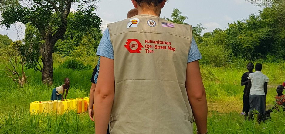
Rapid-onset cases such as this put vulnerable communities at risk because aid agencies and authorities don't have the data they require. Not being able to find villages and settlements; not knowing where roads lead; and not being able to say with certainty where people may have encountered infected individuals hampered aid efforts. Although there are very few completely unmapped parts of the world, not all places have been mapped in the same level of detail. The need for accurate data is what drives the work of the Humanitarian OpenStreetMap Team, a Microsoft AI for Humanitarian Action program grantee.
Read More at Microsoft On The Issues.
With close ties to both the US and China, can Singapore survive in an increasingly fragmented and chaotic world? Singapore’s President Tharman Shanmugaratnam joins Ian Bremmer on the GZERO World Podcast.
Think you know what's going on around the world? Here's your chance to prove it.
This week, Prime Minister Keir Starmer became the first UK leader to visit China in eight years. His goal was clear: build closer trade ties with Beijing.